
Geography
Between the Balkan Mountains and Sredna Gora, close to Sofia.
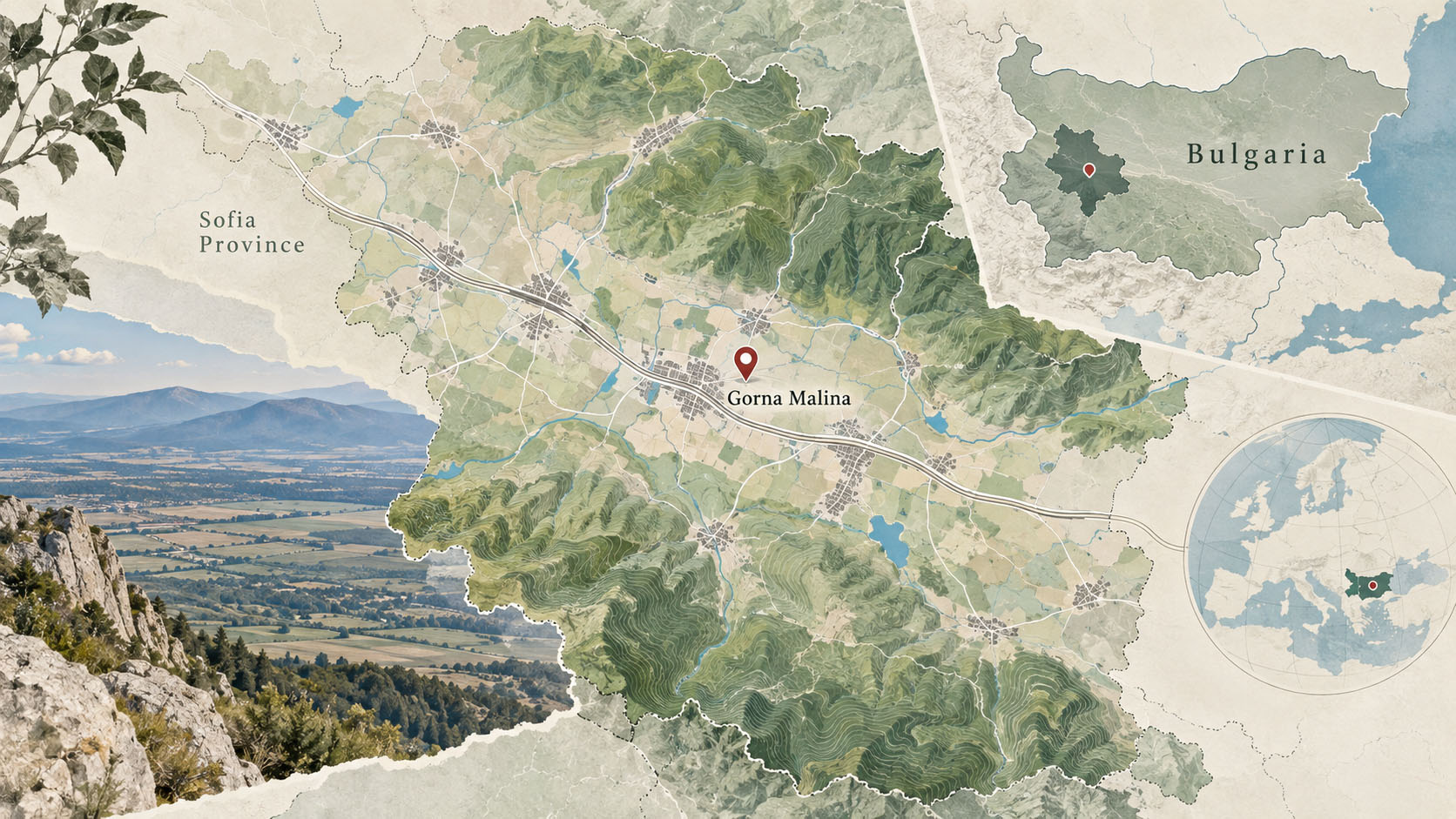
Gorna Malina Municipality lies 31 km east of Bulgaria’s capital, approximately thirty minutes by car from central Sofia. It covers 336.3 km² in the central part of western Bulgaria, between the ridge of the Balkan Mountains to the north and Sredna Gora to the south. Its administrative centre is the village of Gorna Malina. The municipality comprises 14 villages: Aprilovo, Baylovo, Belopoptsi, Gaytanevo, Gorna Malina, Gorno Kamartsi, Dolna Malina, Dolno Kamartsi, Makotsevo, Negushevo, Osoitsa, Sarantsi, Stargel and Chekanchevo, with a combined population of more than 10,000.
The municipality forms part of Sofia Province and accounts for 4% of its territory. It borders the municipalities of Botevgrad, Pravets, Etropole, Elin Pelin and Mirkovo.
Elevations range from 584 m in the territory of Dolna Malina to 1,655 m at Zvezdets (Shindarnika) Peak, in the territory of Stargel. Located in the Balkan Mountains on the boundary between Gorna Malina and Etropole municipalities, Zvezdets is the municipality’s highest peak. The second-highest peak in Gorna Malina Municipality is Opor in Sredna Gora, at 1,089.2 m. It lies 3.1 km northeast of Baylovo and 4 km southeast of Makotsevo.
This post is also available in:


